Friday, July 31, 2020

Glacier Bay National Park - UNESCO World Heritage Site

Place: Glacier Bay National Park
Weather: Rain, 56/67F.
Route: Google maps couldn't find the way, but according the the NPS website there is a regular ferry between Juneau and Gustavus.  So, from Kluane National Park it is 415 km SSE on Haines Highway, ferry from Haines to Juneau, then ferry from Juneau to Gustavus. It appears as though most people who visit the park do so from the deck of a cruise ship.
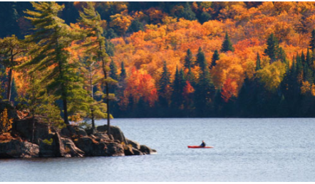
Significance: It is the marine part of the same UNESCO World Heritage Site as Kluane.  Although it does contain 3.3 million acres of mountains and forests along with the coastline.  The largest animals in the park are of course the humpback whales that come here every summer to feed on the abundant fish. The melting glaciers are nutrient rich, which helps to feed the food chain all the way to the top. There are also killer whales, harbor seals, and 280 kinds of birds.  There are also many of the land mammals that we've seen in Kluane and Denali, including bears, mountain goats etc.


Images:

The mammoth glaciers are what draw most people to the park (from nps.gov)

The marine wildlife is the other main reason people visit (from visittheusa.com)

Thursday, July 30, 2020

Kluane National Park, Alaska - UNESCO World Heritage Site

Place: Kluane National Park
Weather: Mainly sunny, 46/74F
Route: From Anchorage 609 miles east on AK-1 N, AK-2 S, Yukon 1 E.
Significance: It is part of the UNESCO World Heritage Site that also includes Wrangell-St. Elias, Glacier Bay, and Tashenshini-Alsek National Parks, some of which are in Canada and some in Alaska.  Kluane is in the Yukon Territory - it contains Canada's highest peak. You can watch glaciers calve into the Alsek River.  It also contains a very large population of Grizzly bears and many of the same mammals that one would see in Denali.


Images:

Glaciers meeting at the base of the mountain range (from viator.com)

Kathleen Lake (from travelyukon.com)

Wednesday, July 29, 2020

Anchorage, Alaska

Place: Anchorage, Alaska
Weather: Mainly sunny, 56/76F.
Route: From Denali 239 miles south on AK-3 S.
Population: 288,000 (2019)
Nickname: The City of Lights and Flowers.


Images: 

Downtown Anchorage (from govtech.com)

A local resident (from adfg.alaska.gov)

Tuesday, July 28, 2020

Denali National Park, Alaska

Place: Denali National Park, Alaska
Weather: Mainly cloudy, 48/66F
Route: From Juneau 855 miles NW on ferry to Haines, Yukon 1 W, AK-2 N.
Significance: I could just say, it has the highest point in North America at 20,310 feet and end at that.  But as the NPS website says, "it's more than a mountain."  Inside it's 6 million acres of wild land are many animals you would expect in Alaska, like bears, wolves, caribou, moose, squirrels, eagles etc.  The park was actually created in 1917 to protect the Dall sheep, which are pure white bighorn sheep.  There are actually many lower elevation areas in the park as well.


Images:


Mt. Denali from Reflection Pond (from nps.gov)

Dall sheep (from nps.gov)

Monday, July 27, 2020

Juneau, Alaska

Place: Juneau, Alaska
Weather: Rain, 49/58F
Route: From Nahanni National Park 974 km SW on YT-10 S, YT-4 E, Ferry from Skagway to Haines, Ferry from Haines to Juneau.
Population: 31,974 (2019)
Interesting fact: Juneau is the only state capital in the United States other than Honolulu, Hawaii that one cannot drive to from another state capital. The only way to get to Juneau is by plane or ferry due to the surrounding terrain of the city.  


Images:


Downtown Juneau (from thealaskalife.com)

Jensen-Olson Arboretum (from beta.juneau.org)

Sunday, July 26, 2020

Nahanni National Park - UNESCO World Heritage Site

Place: Nahanni National Park
Weather: Intervals of clouds and sunshine, 55/78F.
Route: From Yellowknife 699 km west on Frontier Trail, Mackenzie highway, Yellowknife highway, NT-3 S.
Significance: I have to admit that I didn't have any idea that this kind of natural landscape existed in this part of Canada. The main axis of the park is the South Nahanni River, "one of the most spectacular wild rivers in North America" as UNESCO says.  There are few roads in the park - so most people travel by air to different areas of the park.  There are a diverse number of animal species, including the expected caribou and bear.  Granite peaks rise dramatically from the meadows. Virginia Falls, one of the largest falls in the Americas is also within the park.


Images:

Virginia Falls, twice the size of Niagara (from spectacularnwt.com)

South Nahanni River (from spectacularnwt.com)

Saturday, July 25, 2020

Yellowknife, Northwest Territories

Place: Yellowknife, Northwest Territories
Weather: Partly to mostly cloudy, 52/69F. Sunrise 4:42 am, Sunset 10:43 pm.
Route: From Wood Buffalo National Park 830 km North on Fort Smith Highway, NT-5 S, MacKenzie Highway, Yellowknife Highway, NT-3 N.
Population: 19,569 (2016)
Nickname: Diamond Capital of North America


Images:

Downtown (from spectacularnwt.com)

Aurora Borealis over downtown Yellowknife (from spectacularnwt.com)

Friday, July 24, 2020

Wood Buffalo National Park - UNESCO World Heritage Site

Place: Wood Buffalo National Park
Weather: Mostly cloudy with shower developing, 52/64F
Route: From Edmonton 1,139 km North on AB-44 N, Bicentennial Highway/AB-88 N, AB-35 N, NT-5 N.
Significance:
The name of the park comes from the fact that it has the world's largest herd of Wood Bison, which most people wouldn't be able to tell apart from the American Bison that you see in Yellowstone. The landscape has the "largest undisturbed grass and meadows left in the Americas" according to UNESCO. It is also the only breeding habitat for the endangered Whooping Crane. It is the largest national park in Canada - it would be the 42nd largest U.S. state at 17,300 square miles.


Images:

Inland delta (from whc.unesco.org)

The namesake of the park (from insightguides.com)

Thursday, July 23, 2020

Edmonton, Alberta

Place: Edmonton, Alberta
Weather: Variable clouds with scattered thunderstorms, 55/75F
Route: From Calgary 299 km north on AB-2 N.
Population:
932,546 (2016)
Nicknames: Canada's Festival City, City of Champions, The Oil Capital of Canada.


Images:


Skyline (from walkingontravels.com)


Art Gallery of Alberta (from cbc.ca)

Wednesday, July 22, 2020

Calgary, Alberta

Place: Calgary, Alberta
Weather: Partly cloudy skies, 56/77F.
Route: From Waterton Lakes National Park 261 km north on AB-6 N, AB-3 E, AB-2 N.
Population: 1,239,220 (2016)
Nicknames: Cowtown, Stampede City.


Images:

Downtown Calgary (from travelalberta.com)

Peace Bridge (from atlasobscura.com)

Tuesday, July 21, 2020

Waterton Glacier International Peace Park - UNESCO World Heritage Site

Place: Waterton Glacier International Peace Park
Weather: Generally sunny, 57/82F.
Route: From Head-smashed-in Buffalo Jump 90 km on AB-785 W and AB-6 S.
Significance: The Canadian part of this (first ever) International Peace Park is called Waterton Lakes National Park. Like its neighbor Glacier National Park to the south, it features incredibly dramatic landscapes and diverse amount of plants and animals including top carnivores like grizzly bear, cougar, grey wolf, and wolverine.  The landscape is so dramatic due in part to millions of years of glacial activity.  There are over 600 glacial lakes over the two parks.


Video:


Images:

Waterton Lake (from experiencemountainparks.com)


A local enjoys the waters of Waterton Lake (from thecanadianencylopedia.ca)

Monday, July 20, 2020

Head-Smashed-in Buffalo Jump - UNESCO World Heritage Site

Place: Head-Smashed-in Buffalo Jump
Weather: Sunny along with a few clouds, 55/78F
Route: From Regina 694 km west on Trans-Canada Highway and AB-3 W.
Significance: Although Bison were important to all Native Americans (called Aboriginal people in Canada) on the plains, nowhere is that relationship more dramatic than at this site.  For 5,500 years indigenous people used a 10 meter cliff to kill Bison.  During most of this time they didn't have horses - so they would run the bison down "drive lanes" to the highest point of the cliff. They would then finish off the Bison at the bottom of the cliff and prepare them for many uses (food, clothing, shelter etc).


Images:

The Cliff (from pg.gc.ca)

Alfred Jacob Miller's "Buffalo Jump" painted in 1859-60 (from smithsonianmag.com)

Sunday, July 19, 2020

Regina, Saskatchewan

Place: Regina, Saskatchewan
Weather: Sun in the morning with increasing clouds during the afternoon, 51/70F.
Route: From Winnipeg 573 km West on Trans-Canada Highway.
Population: 215,206 (2016)
Nickname: The Queen City

Images:

Saskatchewan Legislative Building and downtown Regina (from canadianimmigrant.ca)


Business District (from careers.workopolis.com)

Saturday, July 18, 2020

Winnipeg, Manitoba

Place: Winnipeg, Manitoba
Weather: Scattered thunderstorms in the morning, then partly cloudy late, 62/84F.
Route: From Thunder Bay 702 km WNW on Trans Canada highway and ON-17 W.
Population: 705,244 (2016)
Nicknames: Winterpeg

Images:

Downtown Winnepeg (from macleans.ca)

Esplanade Riel Bridge over the Red River (from immigratemanitoba.com)

Friday, July 17, 2020

Thunder Bay, ON

Place: Thunder Bay, ON
Weather: Mainly sunny, 61/83F
Route: From Sault Ste. Marie 705 km NW on Trans-Canada highway and ON-17 N.
Population: 107,909 (2016)
Nicknames: Canada's Gateway to the West, The Lakehead.


Images:

Waterfront with "Sleeping Giant" in the background (from visitthunderbay.com)

Marina and downtown (from gotothunderbay.ca)

Thursday, July 16, 2020

Sault Ste. Marie, ON

Place: Sault Ste. Marie, ON
Weather: Cloudy in morning, mainly sunny skies in the afternoon, 62/82F.
Route: From Algonquin National Park 578 km west on Trans Canada Highway, Highway 17.
 Population: 73,368 (2016)
The two "Soo's": The cities on both sides of the U.S./Canada border are called Sault Ste. Marie.  That's because prior to the War of 1812 they were the same city - until the border was moved here.  The Canadian side has the larger population, but the U.S. owns the "Soo locks" - one of the busiest locks in the world by tonnage. The locks make it possible for ships to traverse the rapids of the St. Mary River and get from Lake Huron to Lake Superior.

Images:

Downtown and waterfront (from algomacountry.com)

Soo Locks (from michiganradio.com)

Wednesday, July 15, 2020

Algonquin Provincial Park

Place: Algonquin Provincial Park
Weather: More clouds than sun, 61/81F.
Route: From Ottawa 247km west on Trans Canada Highway, ON-417 W, ON-60 W.
Significance: Algonquin was founded in 1893, making it the oldest provincial park in Canada.  It is almost 3,000 square miles and is on the border of deciduous and coniferous forest, making for a diverse number of plants and animals. There are over 2,400 lakes and 1,200 km of streams and rivers.  There are bear, moose, deer, wolf, 272 species of birds etc. 

Images:

Much of the interior has no roads - so canoes are the preferred method of transportation (from discovermuskoka.com)

Autumn in the park (from algonquinbound.com)